Tsunami detection via ionosphere: the new frontline in early warning
Tsunami detection via ionosphere is moving from bold idea to proven capability. In July 2025, a massive magnitude-8.8 earthquake off Russia’s Kamchatka Peninsula launched tsunami waves across the Pacific. As emergency sirens sounded and millions evacuated coastal zones from Japan to Hawaii, a different kind of wave raced overhead—subtle ripples in the ionosphere—that helped scientists watch the tsunami unfold in near real time. This watershed moment showcased NASA’s GUARDIAN system, a near-real-time GNSS-ionosphere monitor that can flag tsunami signatures by “listening” to how satellite navigation signals are perturbed high above Earth. SpringerLink+3Reuters+3The Guardian+3
The 2025 Kamchatka earthquake: scale, alerts, and evacuations
On 30 July 2025, the Kamchatka quake—one of the strongest globally in recent decades—triggered tsunami warnings across the Pacific Basin. Japan ordered large-scale evacuations (reportedly near two million people), Hawaii activated coastal evacuation protocols, and cities around the ring of fire braced for impact. While some places saw only modest surges, Russia’s Severo-Kurilsk reported damaging waves, and the quake’s reach spurred precautionary measures from Alaska to Latin America. The key storyline for science and public safety, however, was what happened overhead: the atmosphere itself became a sensor. TIME+2The Guardian+2
How “tsunami detection via ionosphere” actually works
From ocean heave to sky ripple
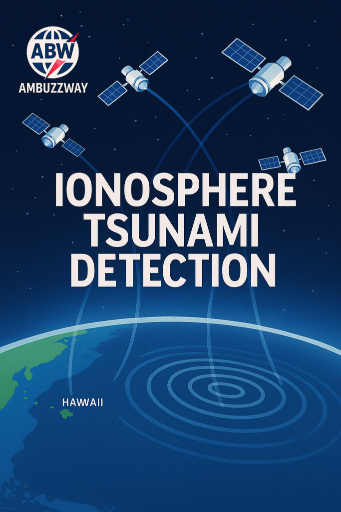
When a tsunami crosses the open ocean, its wave height may be just a few tens of centimeters, yet it moves an immense volume of water over colossal areas. That vertical motion pushes and pulls the air above, launching gravity waves upward. Hundreds of kilometers overhead, in the ionosphere (a layer rich in charged particles), those atmospheric waves briefly change the number of electrons along satellite-to-ground paths. GNSS receivers notice this as tiny, time-varying delays in dual-frequency signals—measurable changes in total electron content (TEC). Detect enough of these ripples across a network, and you can infer a tsunami is underway. This is the core of tsunami detection via ionosphere. Nature+1
The GUARDIAN system in a nutshell
NASA’s GUARDIAN (GNSS Upper Atmospheric Realtime Disaster Information and Alert Network) automates that inference. It continuously ingests dual-frequency data from a global network of GNSS stations (350+ in JPL’s coverage), computes TEC time series, and flags unusual traveling ionospheric disturbances consistent with tsunamis, volcanic eruptions, rocket launches—or even underground nuclear tests. In ideal configurations, GUARDIAN can reveal evidence of a tsunami as far as ~1,200 km (745 miles) from a station, potentially offering up to ~80 minutes of actionable lead time for some coastlines. Think of it as a “space-aided” early warning lens that complements ocean buoys and seismic networks. NASA Earthdata+3guardian.jpl.nasa.gov+3NASA Jet Propulsion Laboratory (JPL)+3

Why the ionosphere is such a powerful sensor
- Global reach without wet hardware: The ionosphere spans the globe, and GNSS receivers are already widespread. You’re leveraging an existing, resilient system rather than deploying new ocean hardware everywhere.
- Independent confirmation: Seismometers tell you there was a quake; DART buoys sample the ocean directly along sparse points. Ionospheric signatures can confirm that a basin-scale ocean wave is, in fact, propagating—a critical filter for false alarms.
- Rich physics: The “noise” GNSS engineers once removed for positioning accuracy turns into signal for hazard detection. That reframing—treating TEC disturbances as fingerprints of big events—opened a new frontier in tsunami science. NASA Jet Propulsion Laboratory (JPL)
From theory to practice: the decades-long arc
Early concepts to modern capability
As early as the 1970s, scientists proposed that radio signals might reveal ocean-atmosphere coupling during major events. The explosion of GNSS in the 1990s–2000s, together with denser receiver networks, made it feasible to look for traveling ionospheric disturbances (TIDs) at scale. By the 2010s, multiple studies demonstrated that ionospheric TEC anomalies matching known tsunamis could be detected—and even used to assess whether an earthquake was tsunamigenic within minutes. These milestones laid the groundwork for a production-grade system like GUARDIAN. Nature+1
Airglow and the light-upside of the sky
The same gravity waves that modulate TEC can also flicker the upper atmosphere’s faint natural glow—airglow—making tsunamis visible to specialized cameras and satellites at night. Airglow work led by researchers like Michael P. Hickey helped solidify the physics of how ocean-driven disturbances propagate to the mesosphere and lower thermosphere. It’s a complementary window alongside GNSS that strengthens confidence in detections. commons.erau.edu+1
What happened in July 2025: a step-change moment
Real-time confirmation during the Kamchatka tsunami
During the Kamchatka event, near-real-time ionospheric monitoring picked up TIDs consistent with an active tsunami, offering situational awareness while the wave train was still en route across the Pacific. Reports following the event highlighted how GUARDIAN’s automated analytics can “catch the wave” in progress, validating years of R&D and demonstrating that tsunami detection via ionosphere is no longer just a retrospective science experiment. NASA Jet Propulsion Laboratory (JPL)
The public-safety angle: minutes matter
For coastal communities hours away from a source, every extra minute sharpens decision-making: where to route traffic, how to sequence hospital transfers, which harbors to clear, and when to relax alerts without eroding trust. The 2025 event caused damaging local floods in parts of Russia, while many far-field regions reported only modest surges. But had conditions been worse, the added confidence from GNSS-ionosphere cues could have been lifesaving. TIME+1
Where GUARDIAN fits with DART buoys and seismic networks
NOAA’s DART: gold standard, but sparse by necessity
NOAA’s Deep-ocean Assessment and Reporting of Tsunamis (DART) network provides direct, highly trusted measurements of tsunami waves in the deep ocean. Yet ocean basins are vast, buoys are expensive, and storms or vandalism can take units offline. You want redundancy—and diversity—in your sensing stack. nctr.pmel.noaa.gov
A layered early-warning architecture
An optimized stack looks like this:
- Seismometers rapidly characterize earthquake magnitude, location, depth, and initial mechanism.
- GUARDIAN (GNSS-ionosphere) confirms or challenges the tsunami hypothesis by spotting basin-scale atmospheric ripples, sometimes within tens of minutes.
- DART buoys provide direct ocean confirmation and wave amplitude/period data to drive forecast models.
- Coastal tide gauges and radar validate nearshore arrival, refine inundation forecasts, and guide all-clear decisions.
Each layer has strengths and gaps; together, they create a resilient system that balances speed, coverage, and accuracy. nctr.pmel.noaa.gov+2SpringerLink+2
Benefits and limitations of tsunami detection via ionosphere
What it does exceptionally well
- Broad coverage with existing infrastructure: Hundreds of GNSS receivers feed continuous dual-frequency data.
- Independent, physics-based evidence: Helps reduce false positives from seismic-only inferences.
- Early visibility across ocean basins: In favorable geometries, GUARDIAN has demonstrated potential warning horizons approaching ~1 hour 20 minutes. NASA Jet Propulsion Laboratory (JPL)
Where caution is needed
- Near-field lag: The ionosphere takes minutes to tens of minutes to respond. For communities close to the source, that’s often too late—local tsunamis demand immediate, seismic-driven protective actions.
- Geometry dependence: Signal strength depends on satellite-receiver geometries, receiver density, and background ionospheric conditions (day/night, solar activity).
- Not a replacement: GNSS-ionosphere is an augmentation, not a substitute, for DART and coastal gauges. SpringerLink
Inside the signal: from TEC time series to actionable alerts
Step 1: Clean the data without killing the tsunami
Raw GNSS observations are rife with diurnal trends, satellite biases, and multipath. Detrending and bias-handling methods must strip out slow variations while preserving the tsunami-scale signatures (tens of minutes). Methodological choices—filters, window sizes—affect sensitivity and false-alarm rates, so operational pipelines are tuned and validated on past events and synthetic tests. SWSC Journal
Step 2: Track traveling ionospheric disturbances (TIDs)
Tsunami-driven TIDs have characteristic phase speeds and propagation patterns. Algorithms cross-correlate disturbances across stations and satellites to estimate direction, speed, and coherence, building confidence that the pattern is geophysical—not local noise or a single-station glitch. SpringerLink
Step 3: Fuse with geophysics and models
Once the atmosphere says “something big is moving that way,” the system blends in seismology, ocean models, and (when available) DART measurements to update tsunami arrival times and amplitude ranges along coastlines. With continued refinement, GUARDIAN-like systems could generate auto-updates every ~10 minutes, turning today’s confirmation into tomorrow’s predictive loop. SpringerLink
Beyond earthquakes: volcanoes, rockets, and nuclear tests
Ionospheric ripples aren’t picky about the trigger. The gigantic Tonga eruption in 2022 produced dramatic, globe-circling signatures; rocket launches imprint stair-step disturbances; and even underground nuclear tests have left detectable atmospheric fingerprints. A mature GNSS-ionosphere system doubles as a wide-area “event radar” for the planet. NASA Jet Propulsion Laboratory (JPL)
What the 2025 event changed for emergency managers
Clearer yes/no on “is there a tsunami?”
Early in an incident, decision makers juggle scarce, sometimes contradictory inputs. A GNSS-ionosphere confirmation can push a “maybe” toward a confident “yes” (or “no”), reducing paralysis and enabling swifter evacuations—or quicker stand-downs that preserve public trust. NASA Jet Propulsion Laboratory (JPL)
Better risk communication
Communities are keenly aware of false alarms. Explaining that multiple independent systems—seismic, oceanic, atmospheric—agree strengthens messaging and compliance. “We have confirmation from ionospheric monitoring” is a scientifically accurate, public-friendly phrase that communicates redundancy.
What’s next for tsunami detection via ionosphere
Scaling up station density and coverage
More dual-frequency GNSS receivers near vulnerable coastlines and across the open Pacific, Indian, and Atlantic basins will sharpen detection and shorten uncertainties. Partnerships with national geodetic networks can accelerate this. NASA Earthdata
Smarter, faster analytics
The GUARDIAN roadmap includes more automated detection and forecasting: ingesting live TEC, running pattern-recognition across thousands of station-satellite arcs, and feeding coupled atmosphere-ocean models that update expected arrival times and amplitudes on rolling 10-minute cycles. That’s the frontier turning confirmation into nowcasting. SpringerLink
Integrating with DART upgrades and coastal sensors
As NOAA refreshes DART and coastal tide-gauge networks, data fusion frameworks will matter as much as sensors. The win isn’t a single “best” instrument; it’s a collaborative ecosystem that sees the same wave from beneath, at the surface, and from the edge of space. nctr.pmel.noaa.gov
Practical takeaways for coastal communities
- Heed official alerts first. For nearby earthquakes, self-protect immediately: if the ground shakes long or strong, evacuate to high ground—don’t wait for any system to confirm.
- Expect more layered alerts. In future events you may hear references to ionospheric confirmation. That’s a good sign that multiple systems agree.
- Support local instrumentation. GNSS receivers, tide gauges, and siren networks all matter; community engagement improves coverage and maintenance.
Conclusion: a new layer of certainty from the sky
The 2025 Kamchatka earthquake didn’t become a worst-case Pacific disaster—but it became a best-case test for a new tool. Tsunami detection via ionosphere has matured into a real-time ally for emergency managers, not by replacing the ocean and seismic systems we trust, but by adding a vantage point from 300 kilometers up. As GNSS networks densify and analytics accelerate, that vantage point will translate to earlier, surer calls—exactly what saves lives when minutes matter. NASA Jet Propulsion Laboratory (JPL)+1
External Sources (for reference)
- NASA JPL – About GUARDIAN: near-real-time ionospheric monitoring for hazards. guardian.jpl.nasa.gov
- NASA JPL – “GUARDIAN Tsunami Detection Tech Catches Wave in Real Time” (Sept 12, 2025). NASA Jet Propulsion Laboratory (JPL)
- Journal of Navigation (2023) – “The GUARDIAN system: a GNSS upper atmospheric real-time disaster information and alert network.” SpringerLink+2ACM Digital Library+2
- NASA Earthdata (Dec 13, 2024) – “GNSS data brings forth GUARDIAN.” NASA Earthdata
- NOAA PMEL – DART® real-time tsunami monitoring systems. nctr.pmel.noaa.gov
- Scientific Reports (2017) – Real-time detection of tsunami ionospheric disturbances with GNSS. Nature
- Scientific Reports (2020) – Rapid identification of tsunamigenic earthquakes using GNSS-TEC. Nature
- ERAU (2010) – Atmospheric airglow fluctuations from tsunami-driven gravity waves. commons.erau.edu+1
- Reuters – “Powerful quake in Russia’s far east causes tsunami; Japan and Hawaii order evacuations” (July 30, 2025). Reuters
- TIME – “Sixth-Largest Earthquake on Record Triggers Global Tsunami Warnings” (July 30, 2025). TIME
- The Guardian – “With tsunami warnings lifted, millions return home…” (July 31, 2025). The Guardian